High Island maps and directions
- rod dawg
- TKF 3000 Club
- Posts: 3458
- Joined: Thu Apr 19, 2007 1:26 pm
- Location: rounding up the cronies for some BTB
High Island maps and directions
Here's some maps and directions for the high island area. Hope this answers most questions on general directions
and bait shops. I'll keep updating and adding more. (In process of updating to current maps and pics.)
my route from Huntsville via 1-10 east...
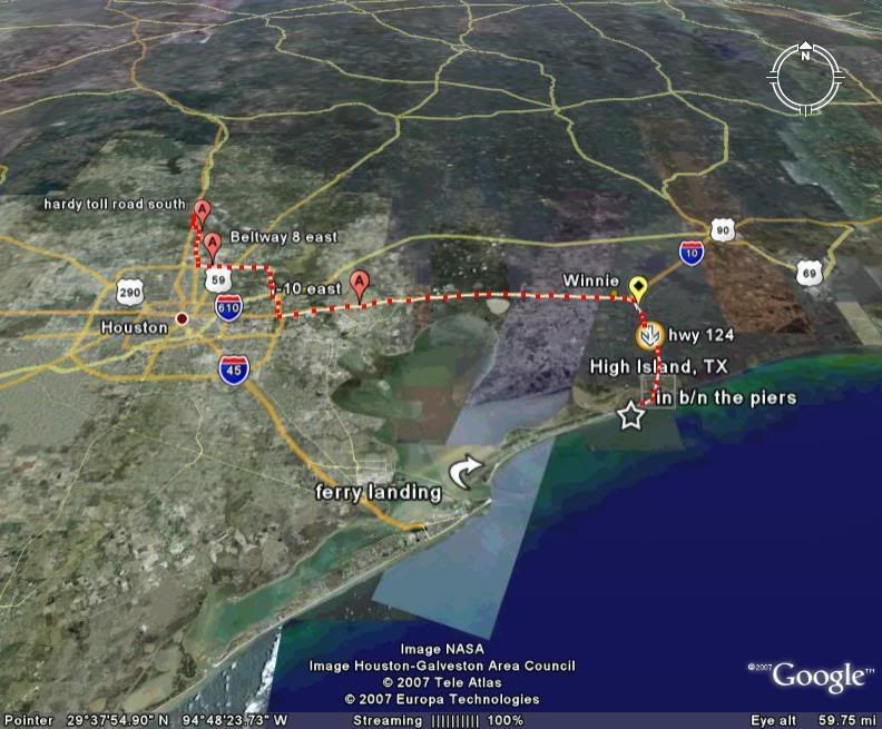
EXIT 828...then go 124 south
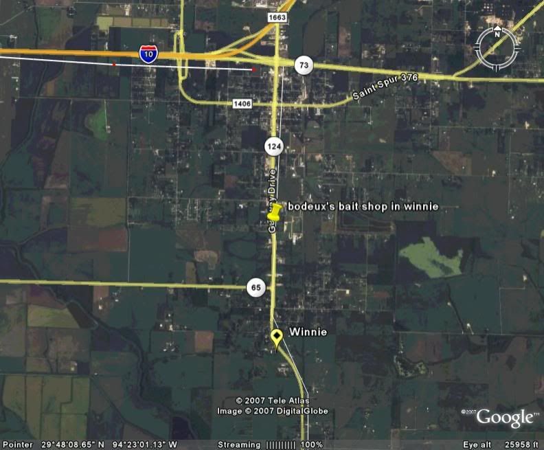
bait shop in winnie....note:Bodeaux's is now George's Bait and Tackle Winnie 409.296.3622.
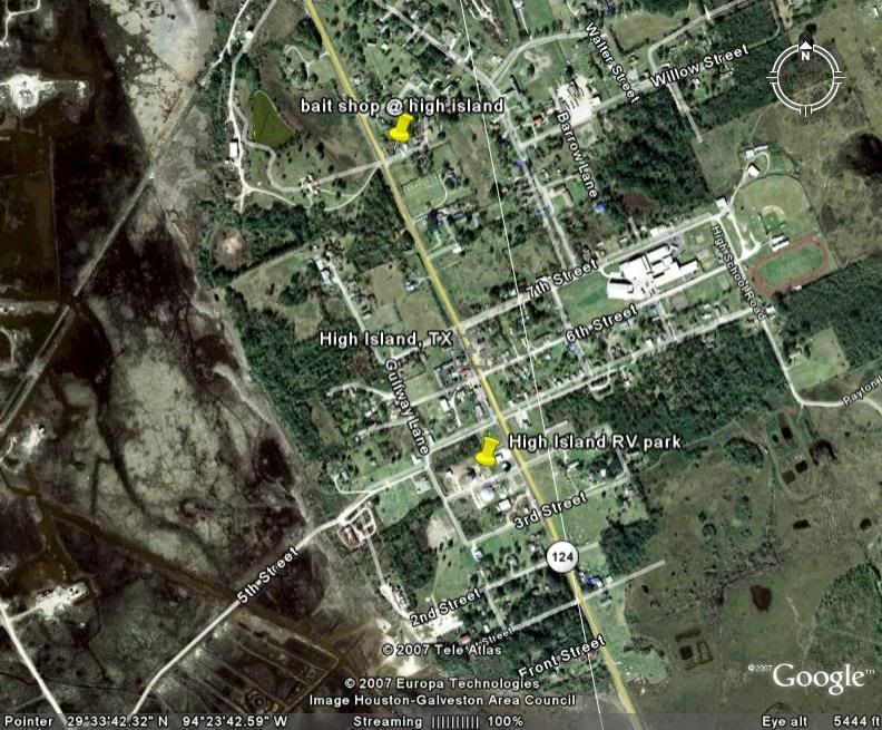
bait shop in High Island and High Island RV Park....
link to http://www.highislandrvpark.com/" onclick="window.open(this.href);return false;
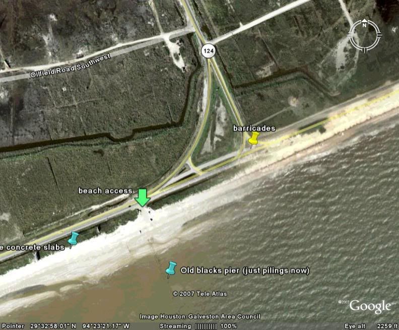
in b/n the piers and other places of interest....
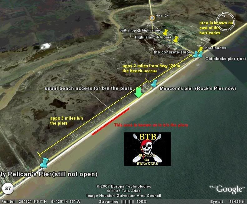
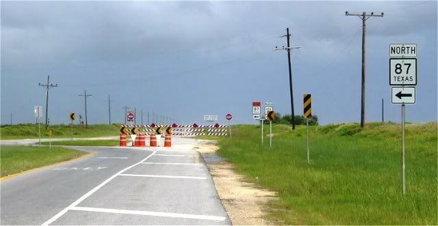
barricades (intersection of 124 and 87)...
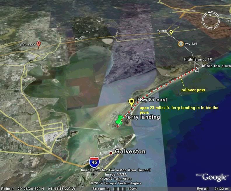
high island via ferry from galveston...
link to map and info on baitshops near high island...
http://maps.google.com/maps?hl=en&ie=UT" onclick="window.open(this.href);return false; ... w=map&cd=2
and bait shops. I'll keep updating and adding more. (In process of updating to current maps and pics.)
my route from Huntsville via 1-10 east...
EXIT 828...then go 124 south
bait shop in winnie....note:Bodeaux's is now George's Bait and Tackle Winnie 409.296.3622.
bait shop in High Island and High Island RV Park....
link to http://www.highislandrvpark.com/" onclick="window.open(this.href);return false;
in b/n the piers and other places of interest....
barricades (intersection of 124 and 87)...
high island via ferry from galveston...
link to map and info on baitshops near high island...
http://maps.google.com/maps?hl=en&ie=UT" onclick="window.open(this.href);return false; ... w=map&cd=2
Last edited by rod dawg on Thu Sep 22, 2011 3:43 pm, edited 6 times in total.
-
- TKF 3000 Club
- Posts: 3030
- Joined: Wed May 02, 2007 8:19 pm
- Location: Solo Skiff Pro Staff - Houston
-
- TKF 1000 Club
- Posts: 1263
- Joined: Thu Oct 27, 2005 12:46 am
- Location: Corpus Christi
- Some Beach
- Posts: 369
- Joined: Tue Jun 26, 2007 11:23 pm
- Location: Tomball/The Woodlands
- WhiskeyBravo
- Posts: 430
- Joined: Sun Sep 16, 2007 7:46 pm
- Location: Houston Heights / OK big game prowler/
- dancingwithbulls
- TKF 1000 Club
- Posts: 1262
- Joined: Wed Nov 29, 2006 11:31 pm
- Location: Spring
I-10 is faster if you miss the ferry. I've tried both ways from kingwood and i usually get to the ferry with a small crowd or just miss it. If you hit the ferry early enough it's pretty close to the same distance. I-10 is quite a boring drive though. Nice maps Rod, you need to get out there soon and get those detour stickers off your yak!
Re: High Island maps and directions
Do I need a parking sticker or beach pass for that area?
Re:
We leave from Montgomery and Dawg's way is definately the best route. Takes us much longer going through Galveston due to the ferry.Some Beach wrote:Thanks RD! You have been so helpful to me and here you go again!
I agree w/FlaFish, this should be a sticky at the top of BTB!
Question: has anyone experimented coming from Spring/The Woodlands using I45 to Galveston, take the ferry and head out to HI? Is it about the same in time/distance?
Re: High Island maps and directions
Great info Rod.
We've got to get you back to the water soon, you've got too much free time on your hands.
Waiting for TJ to add all the beverage stops along the route. Maybe Fla.......... errr someone (ahem) with that type of experience could hi lite the AARP friendly locations as well
We've got to get you back to the water soon, you've got too much free time on your hands.
Waiting for TJ to add all the beverage stops along the route. Maybe Fla.......... errr someone (ahem) with that type of experience could hi lite the AARP friendly locations as well
Re: High Island maps and directions
Excellent Job!
- fishin' soldier
- Posts: 782
- Joined: Mon Jun 09, 2008 11:21 pm
- Location: Liberty, tx
Re: High Island maps and directions
I-10 is faster than the ferry in almost all instances. I would reccomend Exiting HWY 61 in Hankamer and heading south to fm 562 then continuing on around by the Anahuac Wildlife Refuge and Whites Ranch Road dead ends into 124 right North of the ship channel bridge. If you need to stop by bodeaux's though you need to go through Winnie. I come from liberty and I drive this way and can be at the barricades in 45 minutes.